Flush Twice, Cape Needs the Water

That was the common graffiti in St. Louis gas station restrooms in the 60s, when the solution to pollution was dilution and raw sewage was pumped directly into the Mississippi River to become someone else’s problem downstream.

Cape Bicycle worked magic

The good folks at Cape Bicycle dug through their shelves and came with a replacement left shifter and got me back on the road late in the afternoon. (See yesterday’s post.)

While there, I was really impressed with a Surly Long Haul Trucker touring bike on the floor. It’s highly thought of by the phreds. I can see why. It’s a lot of bike for the money.

Time for a test drive

After getting a $20 flu shot, I just barely had time to get in a 12-mile ride before a cold front moved in bringing rain with it.

I used the Cape Recreational Trail to get to the south end of town, where I took city back streets to get down to the site of the Old Mississippi River Bridge which was torn down when a new bridge was built in 2003. It was a shame that the old bridge couldn’t have been left up like the Chain of Rocks Bridge in St. Louis.

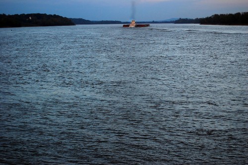
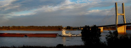
I got there just in time to see a barge push by.

A quick ride to the riverfront

I hurried to get to an opening in the seawall on Water Street, but the barge was moving faster than I could. I had to content myself with a quick shot before it made it past Cape Rock.

The Mississippi River has always been a special place for me. The ocean is neat, but I can sit and watch the river flow by for hours.

As a cub reporter, I had to interview the guy who had been reading the river stages in Cape for 100 years, or so it seemed. The poor fellow had probably been interviewed by two dozen cub reporters like me.

What have you learned about the river?

“If a little boy pees in the river in St. Louis, the river will rise in Cape Girardeau.”

The Southeast Missourian was a pretty conservative paper in those days – one editor would even censor Ann Landers columns – so I’m not sure THAT quote saw print.

“Anything else?

“Big rains make big river.” (That one got in.)

Riverfront is popular

Even though downtown Cape has been in a serious decline since the seawall was constructed, the riverfront is a popular stopping place.

An impressive set of official murals grace the front and back of the wall, but chalk artists have added their own decorations.

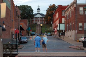
With the sun setting, a couple leave the river front and head out toward the Common Pleas Courthouse, built in 1854.

This was just a quick hit. I’ll return to historical downtown Cape and its river later.

Thursday is going to be a non-biking day. Bro Mark and I have to go over to Kentucky Lake to check on our mother’s mobile home that took some limb hits when Hurricane Ike blew through.

A Piece of Family History on Highway 61

I mentioned that my mother and I journeyed down Highway 61 while scouting out the New Madrid Earthquake bike route.

On the way south, we looked for a piece of property that my dad’s construction company owned in the late 50s.

Dad BUILT Route W

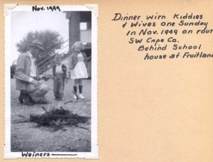
Steinhoff, Kirkwood and Joiner built roads and bridges all over Southeast Missouri in the 50s through the 70s. When I read Southeast Missourian Speak Out folks griping about cyclists on Route W, I think to myself, my dad BUILT Route W. I guess that gives me some right to ride on it.

Needed place to store equipment

Before long, SK&J needed a place to store equipment and a garage big enough to work on bulldozers and other earthmoving equipment.

They bought this land between Scott City and Benton and put up a mechanic’s shed / garage, a shed and several tool buildings.

Dad always wanted a big pond, so they built one on the property and stocked it with bass, crappie, blugills and catfish.

Water moccasins, turtles came on their own

I was an avid fly fisherman and loved to spend hours at the pond. The only bad thing was that you risked sharing your catch with the turtles and water moccasins.

I remember one day that dad and I had a huge stringer of fish we were looking forward to eating. One of us pulled up the stringer to add a new catch and discovered a good-sized moccasin hanging from it.

(1) It doesn’t take a Steinhoff long to look at a snake. (2) We decided that he wanted that stringer of fish more than we did.

We finally found it

After passing by a couple of likely candidates, we doubled back to a property with a pond, a mobile home, a huge brick home and a hundred plastic Halloween pumpkins in front of it.

Jim Pinkston and his son, Jamie, 20, were picking up some limbs when we pulled up.

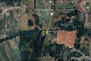
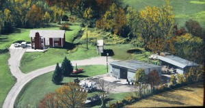
Jim knew right away what we were talking about and he was kind enough to share this colorized aerial photo taken shortly after his father built the house at left.

“My dad bought the property in 1969 or 1970. It included the garage, shed, some tool sheds, a loading dock and 7-1/2 acres of land with the pond,” Jim said.

“He had a trucking business, so the garage was a perfect shop for him,” he continued. They hauled Styrofoam sheets for Dow when it was in Cape. They used damaged sheets on the inside of the garage for insulation. Continue reading “A Piece of Family History on Highway 61”

I’m Retired and Feeling Shiftless

No, my shiftless feeling isn’t related to my lack of employment. It’s because my front shifter went out and the local bike shop doesn’t have a replacement in stock.

I don’t pay much attention to details

I have lots of gadgets on my bike, but I don’t pay a lot of attention to components so long as they work. My left shifty thing adjusts the front gears to make me go faster or easier. My right shifty thing adjusts the rear gears to fine tune what happens related to the front gears.

I NEVER felt the need to go faster

When I bought my used Trek 1220, it came with road gears with 52 teeth on the big front chain ring. That’s so you can go fast. I never said to myself, “I’m in the big ring and I”m pedaling as fast as I can and I want to go faster.”

I HAVE said to myself, I’d sell my firstborn (sorry, Matt) for a lower gear to get up this hill.

I had Wayne (remember Wayne?) swap out the road gears for mountain bike gears with a 46-tooth big ring.

Everything worked fine for awhile

Until, that is, I went for a ride up in South GA on a cold weekend. The temps were in the mid-40s and my gears wouldn’t shift until the day warmed up. Wayne replaced the shifters and life was good again.

Let me explain something about Florida riding: we don’t have hills. We get a nosebleed when we go from the curb to the crown of the road. We diddle with gears to compensate for headwinds and tailwinds, but our low gears are mostly for show.

Compensating for altitude

Jan Norris, my old riding partner and former Palm Beach Post food editor fielded a call from a reader one day asking how much she should adjust the cooking time for altitude. Since subscribers could be anywhere in the country, Jan asked, “Where are you calling from?”

“South Palm Beach,” was the reply.

“That’s sea level,” Jan said. “You can SEE the ocean from there.”

“Yes, but I’m in a condo on the 13th floor,” the caller explained.

Do you see now why we can’t conduct an election without hosing it up?

I needed the granny yesterday

On my first hilly ride this week, I used the full range of gears. Luckily, shifting to the lower ones took just a punch of the button with my thumb. It became increasingly difficult, though, to get into the bigger gears.

Like I wrote before, my mother lives at the top of a hill, so I was in the front granny gear on the way home yesterday. When I started the downhill run this afternoon, I needed to shift up. I pushed as hard as I could with my left hand, but it wouldn’t shift. I had to reach all the way over with my right hand to get it to go.

When I passed the Cape Bicycle Shop it was still open and I stopped in to explain my problem. One of the guys looked at it and thought the cable might be binding on the kickstand plate. It was, kinda sorta, but not really.

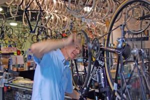
Owner Eric Gooden took a look at it

He was hoping that it might be a frayed cable. I was, too.

I knew I was in trouble when something fell out in his hand and it wasn’t a small mouse that had crawled into the shifter when I wasn’t looking.

Bottom line: it’s broke. There might be a spare off another bike somewhere on a shelf, but if there isn’t, I’m in trouble. They are backordered.

Bro Mark is going to see if they have one in St. Louis, but it’s looking bleak. My bike is old and has seven gears in the back. Spiffy new  bikes have nine or 10, so there isn’t much demand for my flavor of parts.

This might be the excuse I need to upgrade to Shimano Dura Ace ST-7801 Dual Control Levers with matching Shimano Dura-Ace CS-7800 10-speed 12T Cassette, except that they ring in at $400 and $154 respectively, almost exceeding the cost of the bike itself. (And then I’d have to upgrade to a Shimano Dura-Ace CN-7801 10-speed Chain for another $35.)

Worst case, I’ll have them lock me into a middle-range gear and I’ll do a lot of coasting downhill and some slow pedalling or walking uphill. It’s always good to have an excuse for being slow.

New Madrid Earthquake Ride: No Great Shakes

Southeast Missourian webmaster James Baughn does a blog called Pavement Ends where he writes about interesting natural places to see in SE Missouri. His April 23, 2008, blog on the New Madrid Earthquake caught my eye.

Quakes are common

Little tremblors are common if you live in the area and predictions of The Next Big One come every decade or so. Kids hear about the New Madrid Earthquakes of 1811-1812 that caused the Mississippi River to flow backwards, changed the course of the river, created Reelfoot Lake and caused damage as much as 800 miles away.

James’ column mentioned a book, The New Madrid Fault Finders Guide, which costs a measly $16.95 (plus shipping).

It’s well worth the price if you are a history nut, interested in geology or watch reality TV about disasters.

I quickly found I wasn’t so much interested in reading about Pseudosesmic Landforms and Liquefaction as I was in learning that the Mississippi River used to run down the lowlands through Advance and Arkansas, with the junction of the Ohio and Mississippi Rivers being as far south as Natchez, MS, instead of Cairo, IL.

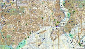
Makes sense when you look at a topo map

The Mississippi is the thin, blue line that’s meandering on the right side of the map. The lighter colors are the lowlands.

I had always heard that the high ridge that runs on the north side of 74 near Dutchtown was the old river boundary. Looks like the oldtimers were right.

What does this have to do with biking?

Seventy-seven pages into the  book, after addressing geology, history and neat disaster stuff, the authors produce the Interstate 55 Fault Finders Guide that will show you significant earthquake features on a mile marker by mile marker basis from roughly Scott City through Blytheville, AR. (They also point out that there is about a 30% chance of a small earthquake being recorded every day when you pass through this zone.)

OK, that’s great. But I can’t ride the interstate

The authors have six non-Interstate loops in the book. I picked the Benton-Sikeston Loop because it’s closest to home and put all the turns into my Garmin nüvi 760 GPS (full review). Because my mother always likes to go exploring, we hopped in her car and headed out on a scouting expedition.

Once you get to Scott City and get on Highway 61, the route is bikeable. I-55 has siphoned off most of the traffic, so I don’t think I’d feel uncomfortable on 61, even if it doesn’t have shoulders. Once you get past Benton and into Morley, the road has wide shoulders.

The backroads are good riding

The book takes you off on a bunch of side roads to look at specific land features. All of them were paved, in good condition and had hardly any traffic.

Fields of cotton will prove that the Missouri Bootheel is the Real South.

Will I bike this route?

No.

The roads are decent and there are interesting things to see, but most of it involves riding on flat roads with no shade. I get enough of that in South Florida.

Even with the guide book, I’m not enough of a geologist to appreciate the subtle changes in the environment to recognize the significance of what I’m seeing.

Still, even I am fascinated to read that the Sikeston Power Plant was built astride a major seismic fissure where the ground split open and quicksand flowed in.

My mother and I DID discover one thing that made the whole trip worthwhile. I’ll cover that later in the week.

I Left My Legs at Home

I set out this afternoon to do what Bro Mark and I call the Uncle Gus route because it goes past a farm owned by a distant relative. It was a great day for a ride: temps were in the low 80s, the sky was overcast and the winds were mild (but increasing).

My mother lives on the top of a hill, so you start out fast until you hit a barricade at the curve at the bottom of the street where there is road construction. It’s paved, so you can dodge the barrier.

The first, gradual climb went OK. I thought that I may have remembered how to do this after all.

Muscle memory

The muscle memory was there, all right. My muscles remembered that they get REALLY tired doing this.

Nothing around here has just one name. Depending on who you talk to, the road I was on is called Old Jackson Road (unless you’re in Jackson, where it’s called Old Cape Road), or Three Mile Creek Road (remember Cape LaCroix Creek from yesterday? Same creek.) On the map, it’s CR 620. At one time, it was the Houck Railroad.

Big rock went boom

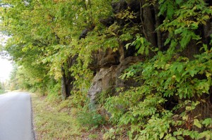
That brings us to this picture. Back in The Day, this was called the Houck Railroad Cut and was a path blasted through the limestone just big enough for a train to pass through. The railroad turned into a regular road and, in the 60s, my dad’s construction company was given the job to make the cut wider.

Someone misjudged the powder load and a huge boulder the size of a kitchen table was launched up, up, up until the law of gravity kicked in. It went right through the roof of a nearby house. No one was hurt, but it became part of family lore ever after.

The road has been widened again, so most folks who drive through there would never know to think of Louis Houck and his railroad.

What goes up comes down

If you check out the ride profile, you’ll see lots of pointy things. Those are hills. A lot of them are more than 12%.

It takes a lot longer to go UP those hills than it does to go down them. I stopped at the top of one of them to see that my GPS said I was at 524 feet above sea level. On the way down, I saw 37 mph on the speedometer. Unfortunately, when I finished coasting, I was at almost exactly 524 feet again and still had about another 150 feet of 12+% grade to climb. Continue reading “I Left My Legs at Home”