Cape Girardeau to Altenburg: My Favorite Ride

One of my favorite rides is the 26-mile stretch between the Mississippi River town of Cape Girardeau to the German settlement of Altenburg, located on a high ridge.

Cape Girardeau to Altenburg


View Cape Girardeau to Altenburg Bike Route in a larger map
[Note: the larger map IS easier to read.]
There are enough hills to be a challenge to a flatlander from Florida, but they aren’t so steep that they are demoralizing. The stretch from Altenburg to Highway 177 was part of the 2009 Tour of Missouri bike race.

Greeted by a vintage bicycle

I stopped in at the Lutheran Heritage Center & Museum to do some research. How could you NOT stop at a place with an unlocked vintage bike at the entrance?
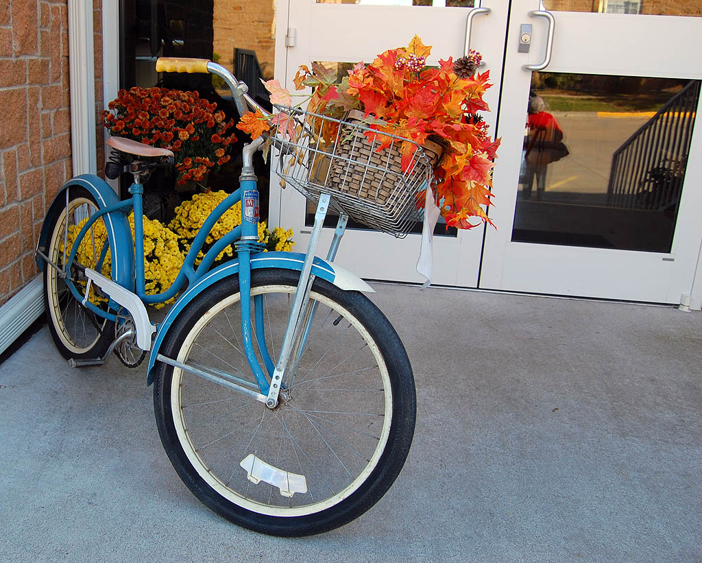
Bicycle in front of Lutheran Heritage & Cultural Center, Altenburg, MO

The friendly folks at the museum were more than helpful. One of the members was under the weather, so he sent his son, Gerard Fiehler, to fill us in on area history.

Carolyn Littge looked at a picture I had shot in the 60s that was labeled “Wittenberg School.” She had no trouble identifying the building. “I not only taught there, but I closed the school down.”

I had taken a picture of a local couple and their visiting friends earlier in the week when they discovered their camera was out of film. I had prints made, but discovered that I had misplaced their mailing address.

Only in a small town could I show the picture to someone and have them recognize the couple and offer to see that they got the prints.

The Aprons of East Perry County

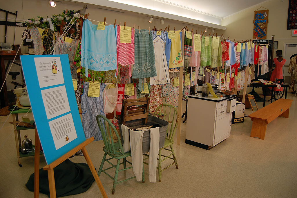
The museum has some wonderful exhibits, but the most eye-catching display was The Aprons of East Perry County.

Many organizations produce cookbooks for fund raisers, but this group decided to have the folks who contributed recipes also bring in their vintage aprons for display.
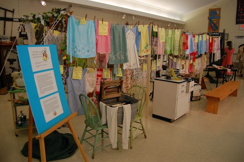
The Aprons of East Perry County exhibitMost aprons were made before 1950

I was surprised to find that some of the aprons I thought were made recently because of their color patterns and the brightness of their colors were made in or before the 1950s.

Wedding aprons
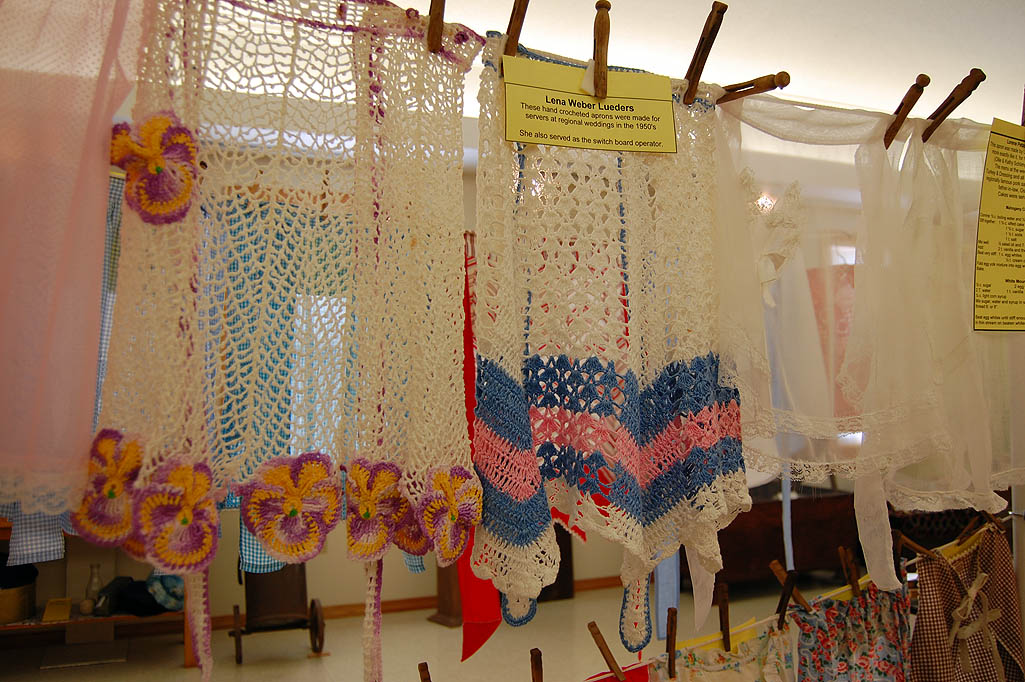
Wedding aprons on display at Lutheran Heritage Center & MuseumA local tradition was for the bride’s family to to make aprons for the regional women who served at the wedding reception tables. Men serving beer would sometimes wear floral or or lace-trimmed beer aprons that matched the wedding motif.

These crocheted aprons were made by Lena Weber Leuders, who also served as the local switchboard operator.

Aprons transition to Christmas Trees

The apron exhibit will come down to make room in early November to make room for the 5th Annual, “Luther’s Indoor Walk in the Woods.”  There will be more than 40 decorated/themed trees on display after November 15.

The Bucket Brigade

The museum’s web site has a great story about Altenburg’s Bucket Brigade, a group of women who have been working as house cleaners for more than 40 years. The youngest is in her 50s and the oldest is in her 80s.
Lake Okeechobee Scenic Trail (LOST) Map

Lake Okeechobee Scenic Trail (LOST) is one of my favorite places to ride. Here’s an unofficial map I put together to show which parts are paved, which parts require you to go on surface roads, trail heads and access points, and a few places to eat.

I plan to do a much more comprehensive piece on the LOST, but I’ve had enough recent requests for information that I thought I’d put this up as a stop-gap.

Lake Okeechobee Scenic Trail (LOST)


View Lake Okeechobee Scenic Trail in a larger map

I encourage you to click on the link to a larger map. It’s easier to see in a new window.

Blue = LOST; Red = Roads

The blue lines represent the paved portion of the trail. The red lines show where you have to exit the LOST and get on public highways.

The roads are good riding

If you are reasonably comfortable riding in traffic, then you should have no problems with the roads around Lake Okeechobee.

  • 78, on the west side of the Lake has wide shoulders and light (but fast) traffic. The rural drivers are friendly and almost always pull over into the other lane to pass, even when I’ve been on the shoulder.
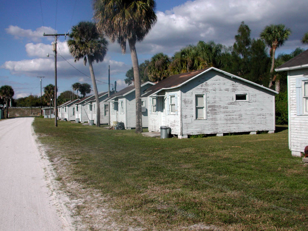
  • 441 on the east side of the lake has been recently repaved. The shoulders aren’t as wide as 78, but they’re fine. I’ve ridden it when it was under construction and the shoulders were broken up and survived.Taylor Creek fishing cabins and shellrock road from LOST to 441
  • The short jog around the Taylor Creek Lock on the north side isn’t a problem if you time your bridge crossing to miss the few short bursts of traffic that come along. Take the lane when crossing the bridge. If you are west bound, plan to move to the left side of the lane as soon as you cross the bridge so you can make a left turn to get back on the dike. The stretch between the dike and the road on the east side of Taylor Creek is shell rock. It’s usually packed pretty solid, but you can hit some soft spots. Be careful if you have narrow tires.

You are isolated on the LOST

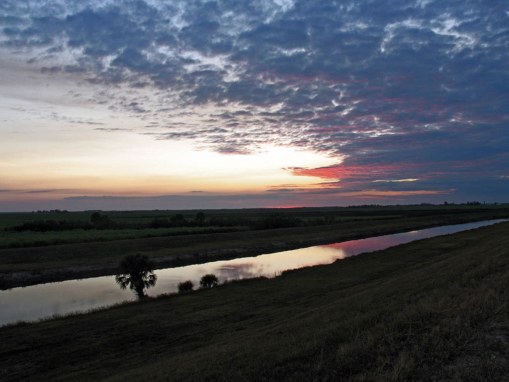
Sunset on the Lake Okeechobee Scenic Trail near Moore HavenOnce you’re up on the dike, you may have to ride seven or more miles to get to an access point because you have the lake on one side and the rim canal on the other.

There are no restrooms on the dike, no food, no services, so be prepared. There ARE primitive camp sites around. Before the authorities cut all the non-native trees and bushes, the campsites were relatively hidden. Now they are wide open.

What all all those blue markers?

I’ve tried to mark all the trail heads and access points I can remember. Some of them may not allow a motorized vehicle to pull in, but they are places where you could reach a road on your bike.

Don’t count on anyone recognizing the names I’ve given those access points. They are just what I call them, usually based on some geographical feature.

Places to eat

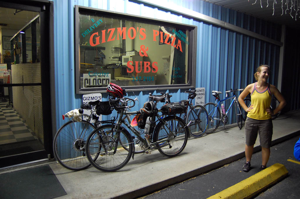
Gizmo's Pizza and Subs near Okeechobee, FL, just off the Lake Okeechobee Scenic TrailI’ve also marked a few places around the north and east side of the lake to eat. I highly recommend The Office bar at Nubbins Slough, Gizmo’s Pizza & Subs at Taylor Creek and the Golden Corral’s all-you-can eat buffet in Okeechobee. [Note Gizmo’s is no longer in business. I hated to see them close.]

I also mark the Scottish Inns in Okeechobee as an inexpensive, clean place to stay. Don’t expect a chocolate on your pillow, but the folks running it are nice and I’ve had a decent night’s sleep there. It’s not a place to park your spouse for the day while you’re out riding, though. The rooms are tiny by today’s standards.

Be careful out there

My riding partner, Mary, and I used to ride without helmets on the LOST because we thought we were more likely to have heat stroke than head injuries on a trail with no motorized vehicles and no obstructions to run into. Mary, for no apparent reason, crashed her bike about a mile north of the Chancey lock and wound up with five skull fractures. Help is a long way away when your partner is unconscious on the ground with head trauma.

Things to bring

  • Food and water
  • Sunscreen (there is no shade)
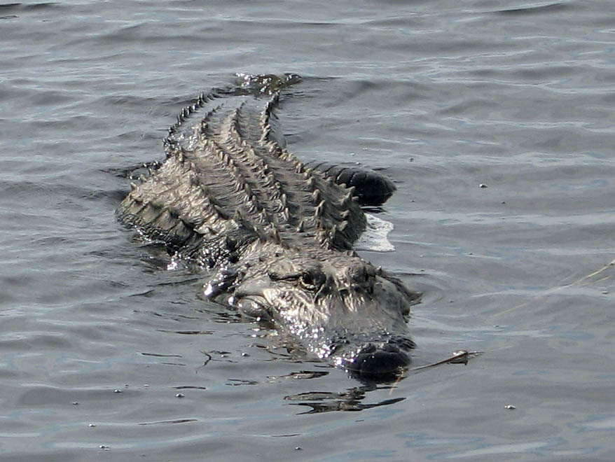
  • Gator on Lake Okeechobee Scenic Trail (LOST)Bug repellant, especially for riding around dusk. Glasses or some form of eye cover keeps flying insects out of your eyes. Some evenings the gnats and other bugs are so thick I pull a bandanna over my nose and mouth to cut down on the amount of protein I ingest.
  • An awareness of the weather. You’re the highest object around for scores of miles. Heat lightning in the distance makes for a great light show, but you want to get off the dike if it starts moving in.
  • A camera. I’ve seen something interesting every time I’ve ridden the LOST.
  • Good sense. Do NOT pet the alligators.

Tour of Missouri Comes to Cape Girardeau

Tour of MissouriStage 2 of the Tour of Missouri is headed to my hometown, Cape Girardeau, on September 8.

Jim Baughn, webmaster of The Southeast Missourian’s web page, has a must-read blog called Pavement Ends where he covers things off the beaten path.

Tour of the Tour of Missouri

His August 31 Tour of the Tour of Missouri Bike Route blog is a collection of photos and descriptions of things along the route that the riders won’t take time to notice.

I love his factoids like A small stretch of Route WW, from Holmes Road south to the terminus with Route T, follows along, or very near, the Three Notch Road. This ancient road, dating from the early 1700s, connected the lead mines at Mine La Motte with the outside world at Ste. Genevieve. It was the first road built in Missouri, although “road” might be a misnomer. Road conditions were so primitive that three lines were notched into trees to reassure travelers that they were still following the road.

One of Jim’s other interests is bridges. Because of that, he takes particular note of some bridges along the way, including a link back to the bridge I’d rather forget from my learning-to-drive days.

I’ve ridden most of this route

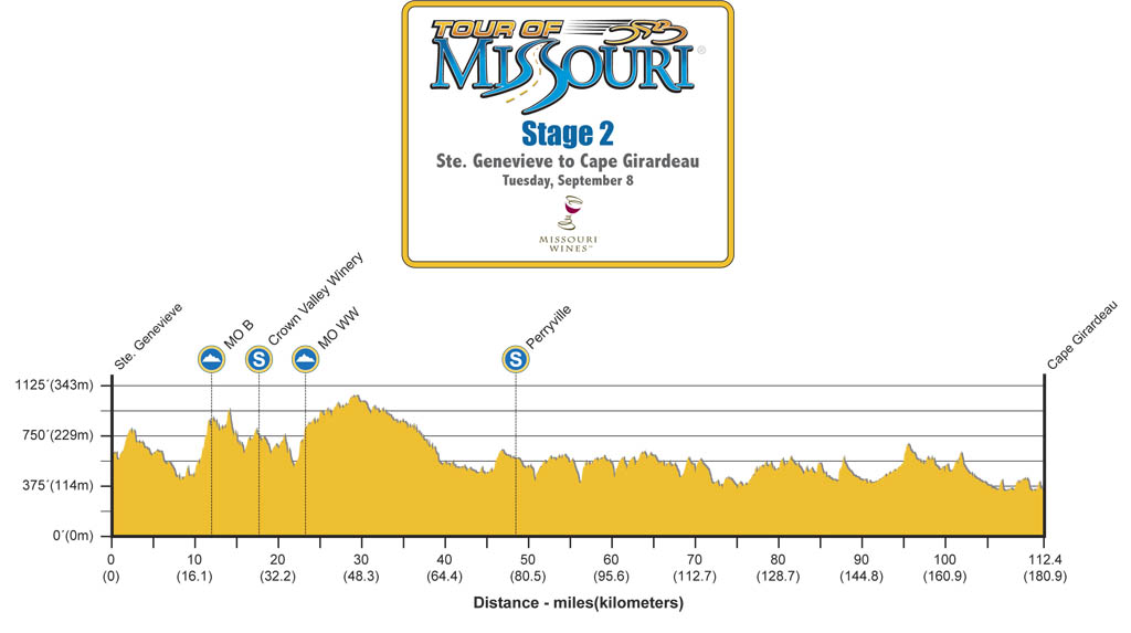
Tour of Missouri Stage 2 Profile

I know these guys are pros who go UP the Alps faster than I’d go down them, but anybody who doesn’t do his homework is going to get caught out when they get to a couple of 90-degree turns hiding short, but steep climbs.

The guys in the front 10 will be OK, but there will be a log jam behind them as everybody jockeys to squeeze the peleton through the narrow space.

Legs and math won’t agree

There’s another factor, too. Missouri doesn’t have a lot of really long climbs, but it has lots of ups followed by downs followed by ups.

A series of 400-foot climbs followed by 400-foot descents may add up to a total altitude gain of zero feet for the day, but your legs are going to let you know that math doesn’t tell the whole story.

They won’t stop in Pocahontas for the hummingbird

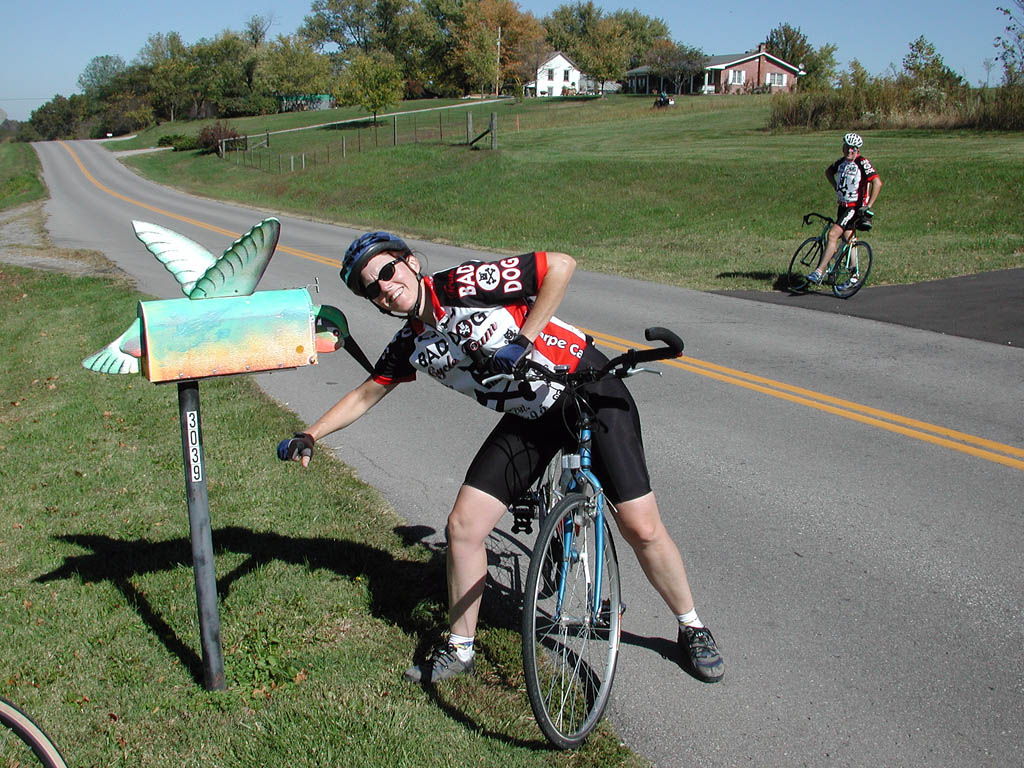
Deeds Bonham and Hummingbird in Pocahontas on Tour of Missouri routeI doubt that they’ll stop for roadside pictures at the hummingbird mailbox in Pocahotas like Bro Mark and Friend Deeds did on our 2003 ride.

When they fly by Altenburg, they could look up and see some attics that used old glass photographic negatives for window panes.

If a breakaway gets a big lead

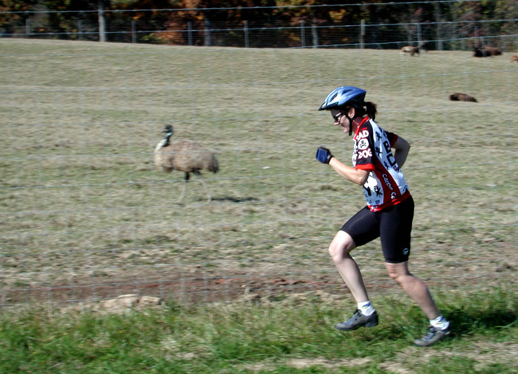
Deeds and OstrichIf there’s a breakaway with a big lead, they can get off their bikes and take a break pacing the exotic animals at a farm along the way.

On their way south, they’ll pass a huge gravel bluff near Oriole where my dad set up a gravel plant to get material for building roads when I was about 10. (See picture on Jim’s blog.) I’m surprised that I didn’t break my neck trying to scale that cliff.

It’s gonna be a good race.

Sightseeing in Palm Beach at Dusk

Several folks liked the picture of Sea Gull Cottage I posted yesterday, so I thought I’d throw up a couple more things I saw on the same ride up the Palm Beach Lake Trail.

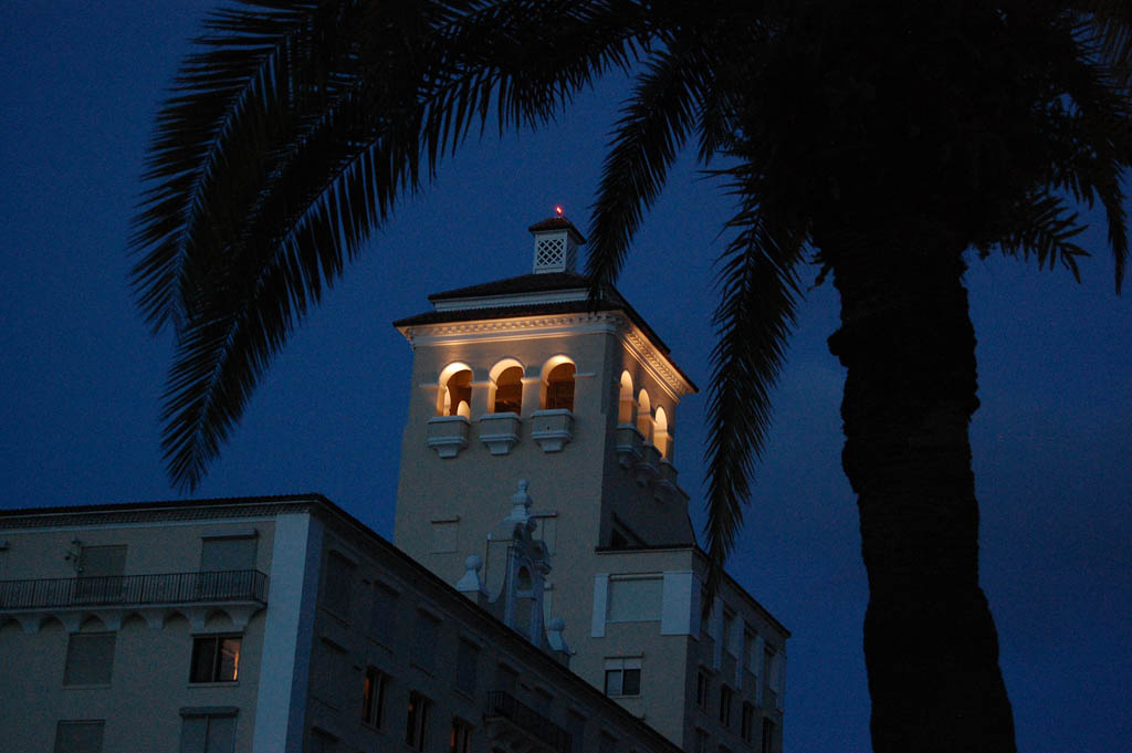
Biltmore Condos, originally Alba Hotel, in Palm BeachWhat is now the Biltmore Condominiums was built in 1926 as the Alba Hotel, was renamed the Ambassador Hotel and finally became part of the Biltmore chain of Hotels.

Biltmore headed for demolition

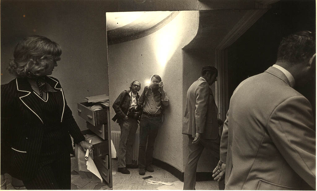
Ken Steinhoff and John Lopinot touring Biltmore Hotel in Palm Beach during the mid-70sWhen Palm Beach Post chief photographer John J. Lopinot shot this picture of the two of us reflected in a mirror on a tour of the place in the mid-70s, there was a very good chance that the building would be demolished.

When I get down to that level in my photographic archeological dig, I’ll post pictures of what a dump it had become.

$10.5M for a Biltmore penthouse?

None of us walking through the Biltmore on that tour would have ever thought that one of the three penthouse apartments would go on the market for $10.5 million in January 2009.

Here are details from Megan V. Wilson’s January 28 story in The Palm Beach Daily News:

With 3,299 square feet, the two-bedroom home at 150 Bradley Place, No. 1002, would have the highest price per square foot for a Palm Beach condo at about $3,183 per square foot…

Biltmore map

Owner Pari-Sima Pahlavi, 81, bought the property with her late husband, Dorrez Dolats, for $2.7 million in 1993, according to property records. Pahlavi is the sister-in-law of the former shah of Iran. Her first husband was the late Prince Abdul Reza Pahlavi.

The Biltmore boasts three penthouses, and the north and south ones sold within a month of each other in 2007 for $6 million and $8.9 million, respectively. The south unit covers 3,914 square feet, and real estate broker Tara Pearl, who represented the buyer during its sale, believes it currently holds the condo record for per-square-foot sales price at about $2,274 a square foot.

In May, developer Stephen Ross’ former Il Lugano penthouse set a local record for total price when Lee and Laura Munder bought it for $12.1 million, but at 5,798 square feet, it cost only about $2,087 a square foot.

[Editor’s note: You know you’re in Palm Beach when someone can use the words “only” and $2,087 per square foot in the same sentence.]

Televisions: modern-day equivalent of flickering candles

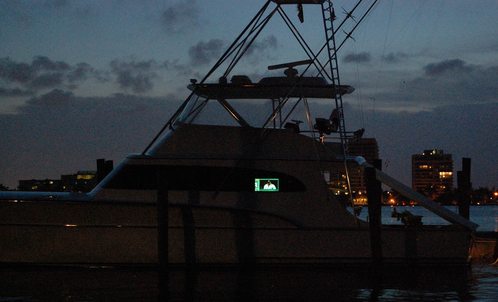
Palm Beach yacht with TV at dusk

Not too far north of the Biltmore on Lake Trail, I spotted a glow coming from a boat moored in the Intracoastal.

Televisions are the 21st Century version of flickering candles.

You’ll soon learn that flickering lights come from TVs, but steady glows are computer monitors.

Sea Gull Cottage, Palm Beach’s Oldest House

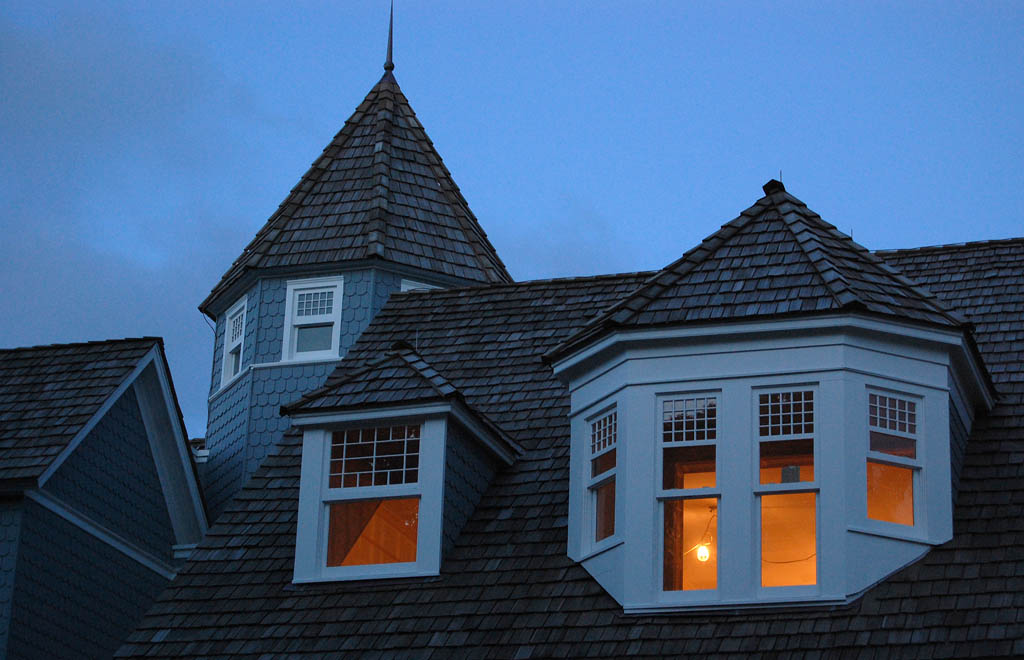
Seagull Cottage, oldest house in Palm Beach and Flagler's first residenceA night ride took me past Sea Gull Cottage in Palm Beach right at dusk. Lights inside the building cast an orange light that contrasted with the cold light of the coming night.

Flagler’s first winter residence

Sea Gull Cottage was built in 1886. Henry Morrison Flagler, the man most responsible for making Florida a winter tourist destination, bought it in 1893 and made it his first winter residence.

The building was originally located north of the Royal Poinciana Chapel. It was moved east to The Breakers in 1913 and used as a rental property. The Preservation Foundation of Palm Beach paid to move it to its present location in 1984 to save it from demolition.

The lights in the windows are from construction workers renovating the interior, adding a 2,000-foot extension to the north side of the building and replicating an octagon-shaped turret that was lost decades ago.

Sea Gull cottage is located next to the Flagler Museum

Seagull Cottage